As a upper trof moves in from the west with better mid and upper level winds associated with it, moisture will begin to return from the south and west as a dryline sets itself up in the dakotas and further south into NE. As Victor and I were just discussing tomorrow looks tough as it looks like maybe two possible targets. One being down possibly in NE where the better instability and moisture is being pegged but away from the better mid-level winds or playing further north in eastern SD under the better winds but less juice but still sufficient. I personally like the northern target with the better wind profiles but as Victor said further south "big CAPE kicks big ass"
500mb speeds at 0z

MLCAPE at 0z

As a target for tomorrow I like Mitchell with possibility of heading north.
Now comes the fun part or day for that matter. I will just go out and say it, play nw KS on weds! It would take some real kahonas to blow off MN/IA and do that :) but I wouldn't considering this setup is going to be a repeat of 6/17 in the AEL area. This setup just looks "good day" 50kts from the WSW at H5, good strong SW H85 winds and nicely backed sfc winds into southern/southeast MN and northern/northeast IA. As Victor pointed out, there looks to be a diffuse warm front from southern MN down across northeast IA. The wind profiles in that area are mmmm good. 0-1 SRH AOA 200 in northeast IA at 0z and only gets better as time goes on.
12z NAM showing CAPE values AOA 3500 j/kg with dew points in the mid 70's possibly nearing 80!

thank you corn!

just look at that theta-e! wow!

Target for weds- sit in AEL to possibly head east on 90 or south on 35 to head into northern or northeast IA.
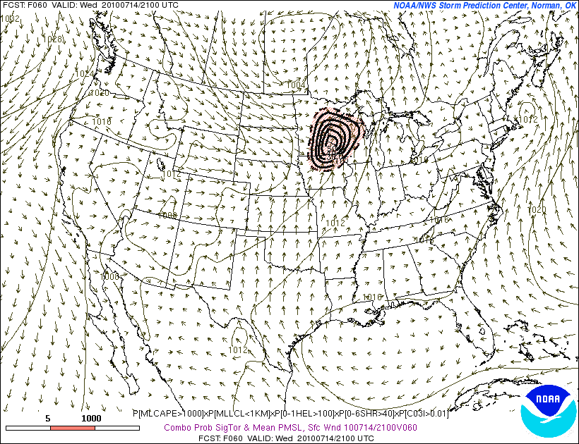
One last images to look at for tornado potential off the 9z SREF for 21z on Weds. last time a 50 was shown...4/22...5/10...6/5
Matt
